


Charter of Operations - NOC Mapping Group Updated 12th December 2022
The aim of the Mapping Committee is to ensure that the maps used in events organised by the Newcastle Orienteering Club are of the highest possible standard.
The Mapping Committee will do this by overseeing, co-ordinating, and developing processes related to the production, maintenance and distribution of the club’s maps that are efficient, practical and sustainable.
NOC encourages membersv to get involved in mapping. However, if you are new to mapping (or if you're experienced and want to start a new project), please first talk with members of NOC's Mapping Group (currently Geoff Todkill, Rob Vincent, Sam Howe, Malcolm Roberts and Ian Dempsey). This will prevent duplication of effort and will ensure your work follows accepted mapping standards.
Be aware of both your personal safety when mapping and that landowner permission is required to run events in most areas.
An orienteering map is of high quality if:
Technically; it conforms to the latest relevant IOF standard
it provides the information necessary to orienteer in the mapped terrain
it is accurate and up to date
Practically; it is clear and readable by the participants
it does not degrade in the environments in which events take place
The Mapping Committee will consist of a main committee and three sub-committees, one for each discipline of Bush/MTBO Orienteering; Urban/Sprint Orienteering; and Street Orienteering. The Technical Officer will be a member of the main committee. Each sub-committee will be managed by the member of the main Mapping Committee, who will report on their activity.
The Mapping Officer will convene Mapping Committee meetings at regular intervals, report activities and make recommendations to the NOC committee. Membership of the Mapping Committee will be by election at the NOC AGM. In case of conflicts of opinion, the ultimate resolution will be made by the NOC committee.
Currently the Mapping Officer is Geoff Todkill; The Technical Officer is Robert Vincent;
Bush/MTBO Orienteering is managed by Geoff Todkill; the Urban/Sprint Orienteering is managed by Ian Dempsey; and Street Orienteering is managed by Malcolm Roberts.
Each sub-committee will be responsible for all aspects of mapping in that discipline.
a. Maintain the NOC map archive and records of map use. The map files will be securely stored with cloud and physical back-ups, with a controlled number of people to have access.
b. Manage the distribution of maps to NOC course planners, and respond to requests from outside agencies.
c. Manage the update of older NOC maps to the relevant mapping standard and manage the ongoing inclusion of map corrections.
d. Develop a sample map to advertise the current mapping symbols to all relevant parties.
e. Maintain a base map file for use in conversion of older maps and for use in new mapping projects.
f. Co-ordinate any mapping activity and develop expertise within the club, by encouraging and mentoring all involved in mapping and course planning.
g. Discuss any significant decisions or actions with the main committee.
Geoff Todkill - Mapping Officer
To Pay for an Event
Log in to Eventor and select the Event you would like to enter and continue to the Payment page.
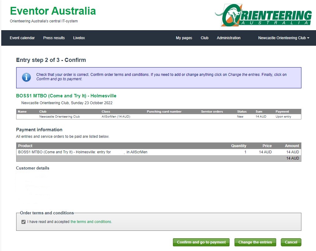
Select "Confirm and go to payment".
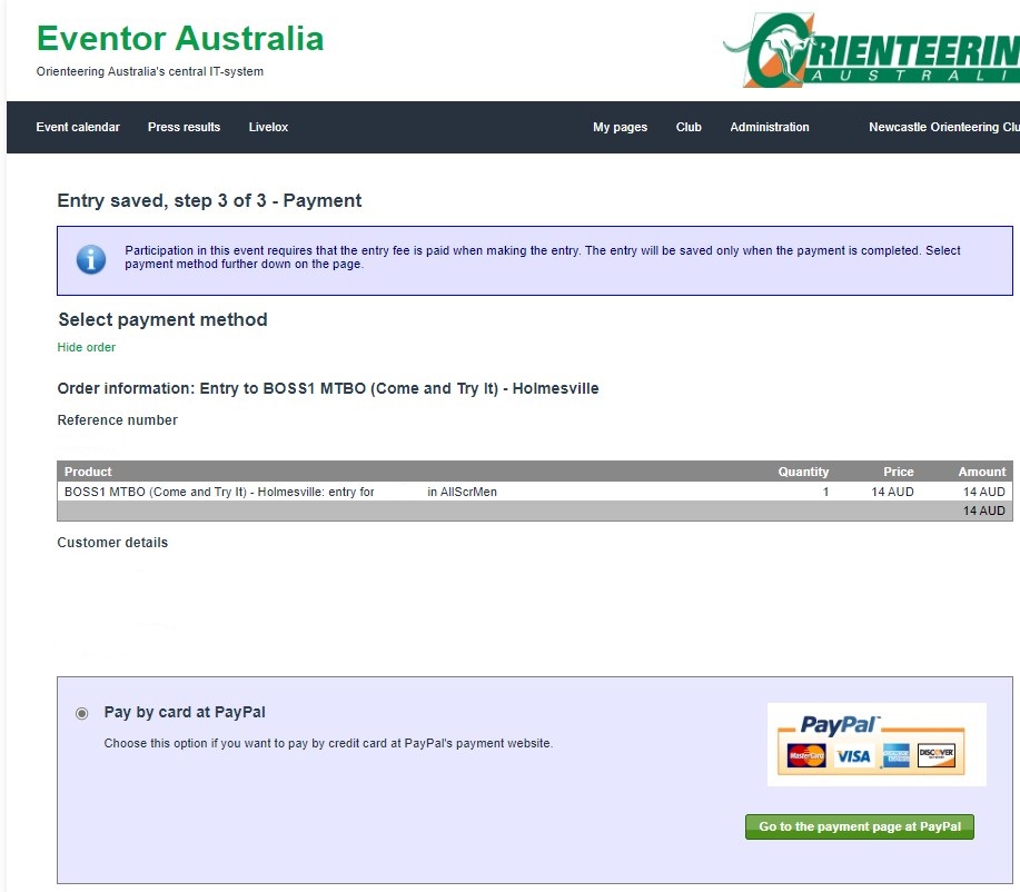
Click on "Go to payment page at PayPal". You will be able to pay using a credit or debit card even if you don't have a PayPal account.

Click "Pay with a Card".
Enter a none PayPal email address (e.g. This email address is being protected from spambots. You need JavaScript enabled to view it.) so you can use PayPal to pay using a card.

Click "Continue to Payment".

Click "Pay with a Card".

Click "Contine to Payment".

Click "Continue as a Guest".
Enter your credit or debit card details.
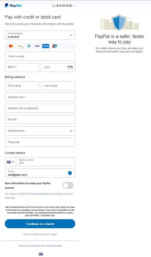
Click "Continue as a Guest".
Here is the link to access Eventor - https://eventor.orienteering.asn.au/Events
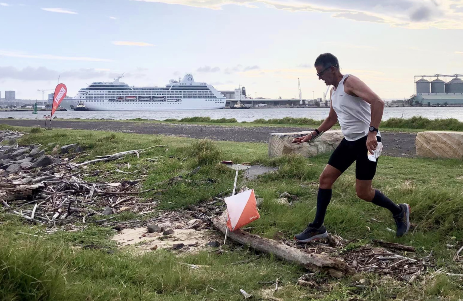
What is Orienteering?
Watch the short introduction to Orienteering videos - "Orienteering - the adventure sport for all ages" and "Orienteering in Australia" .
How do I do a course?
The club hold events on mapped areas of bush, parkland and urban areas within the Newcastle, Lake Macquarie, Maitland, Cessnock, Port Stephens and Singleton local government areas.

When are events held?
You can TRY ORIENTEERING ANYTIME FOR FREE by visiting one of our local Permanent Courses at Blue Gum Hills Regional Park Minmi and at Brickworks Park Wallsend after printing your own map. There is also a permanent course at the Hunter Wetlands Centre (admission fees apply).
What time do events start?
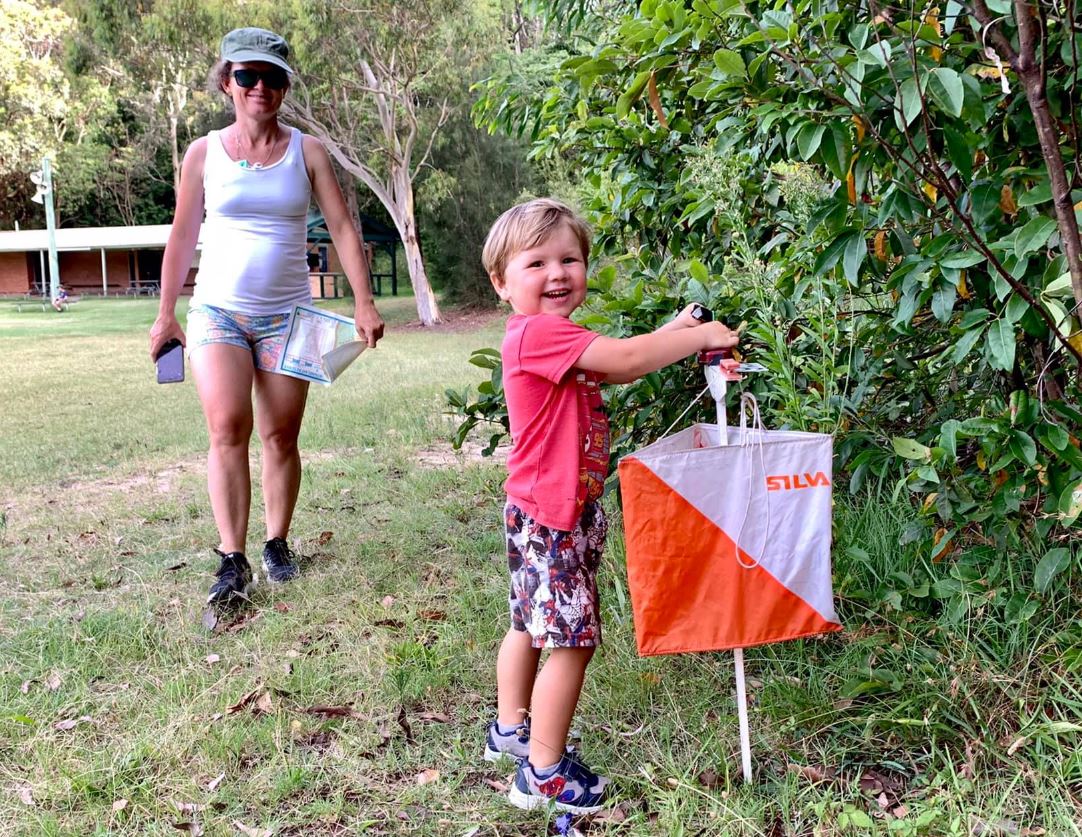
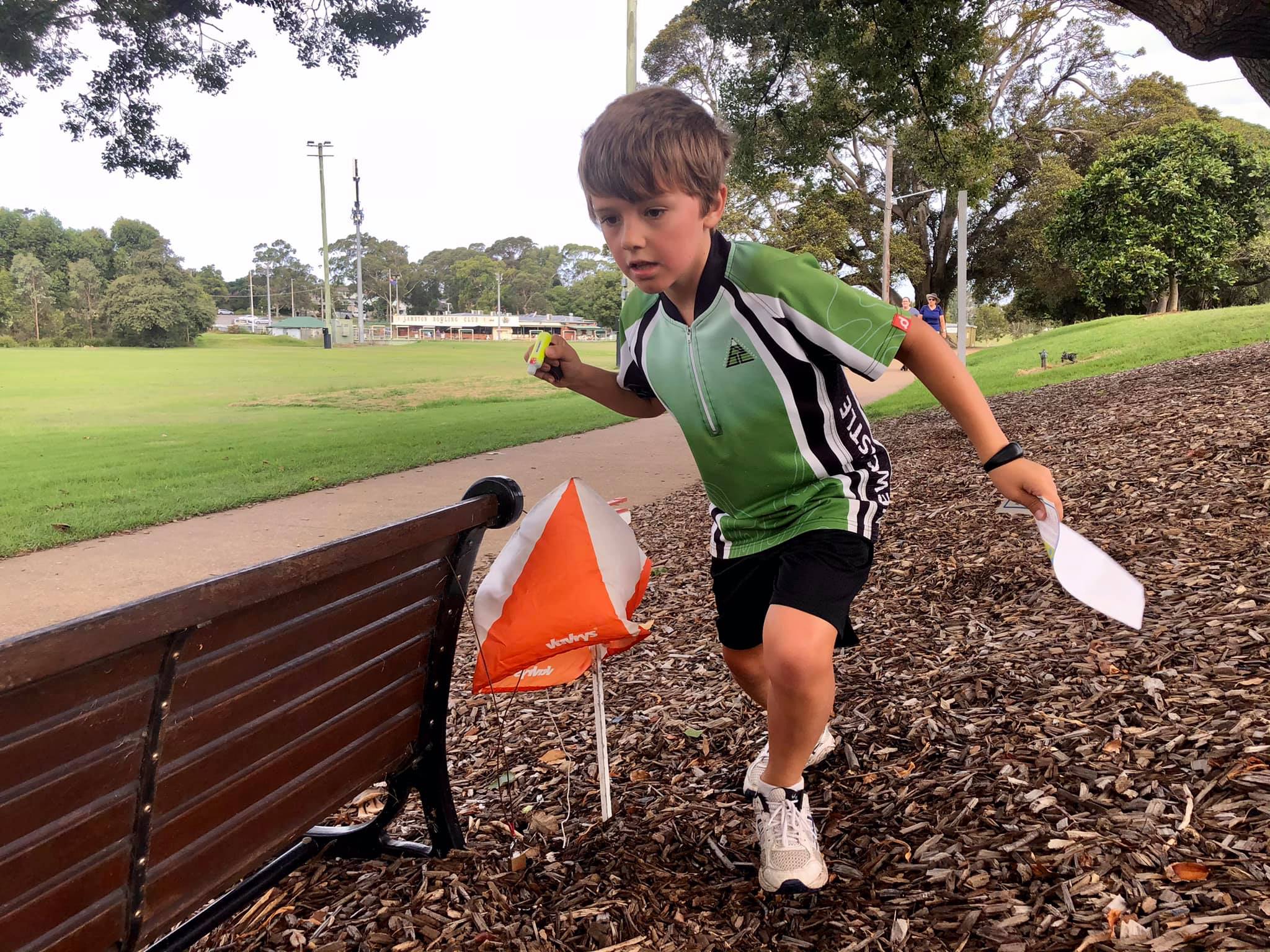
Orienteering attracts a mixture of all age groups and is great family sport as everyone can participate at their own level and at the one venue. Juniors generally need to be about 8-10 years old to undertake a course by themselves and there is no upper age limit - we have 80+ year olds regularly competing. (Note - for safety at Street Orienteering events children under 14 need to be accompanied by someone older).
We have many participants that do their course in pairs or as a team or family group. When you gain more experience you will probably prefer the challenge of navigating and completing the course by yourself.
How competitive is it?
- Very Easy: Simple navigation for juniors or total beginners. All controls are on tracks or along fences, or other easy to follow linear features, and are readily visible when nearby.
-
Easy: Basic navigation. Controls are placed close to tracks, fences, watercourses or other easily followed linear feature. There may be options to "cut across" through the bush.
-
Moderate: Intermediate navigation requiring better map-reading skills. Controls mostly located away from tracks requiring cross-country navigation. Route choice options will require decision-making.
-
Hard: Challenging navigation requiring advanced map reading skills. Controls require cross-country navigation, may be isolated, small "point features" or in complex areas, and may not be visible from the line of approach. Wider choice of routes means greater decision-making.
Street, Urban and MTBO events are mostly at an easy navigational level and generally suitable for most beginners. MTBO events require riders to be competent in riding bush tracks and trails.
How long are the courses?
- Very Easy 1.6 - 2.2 km
- Easy 2.0 - 2.4 km
- Moderate 2.2 - 2.7 km
- Hard 4 2.0 - 2.5 km
- Hard 3 3.0 - 4.0 km
- Hard 2 4.5 - 5.5 km
-
Hard 1 6.0 - 7.0 km
" Orienteers never get lost, they just get navigationally embarassed! ". Whilst every orienteer occasionally has trouble locating a control, if you are on a course that suits your navigational ability and level of fitness you will be able to "relocate" and get back on track. At most local events you will generally never be too far from a road, large recognisable feature or "civilisation". The club has strict safety protocols and procedures which aim to ensure competitors can't stray too far off course, and for locating competitors who may be overdue on their course.
Is coaching available?
At every event there will be experienced club members available and happy to provide help and advice, both before and after you undertake your course. The club holds occasional training events throughout the year to assist people improve their navigation with map and compass and orienteering skills.
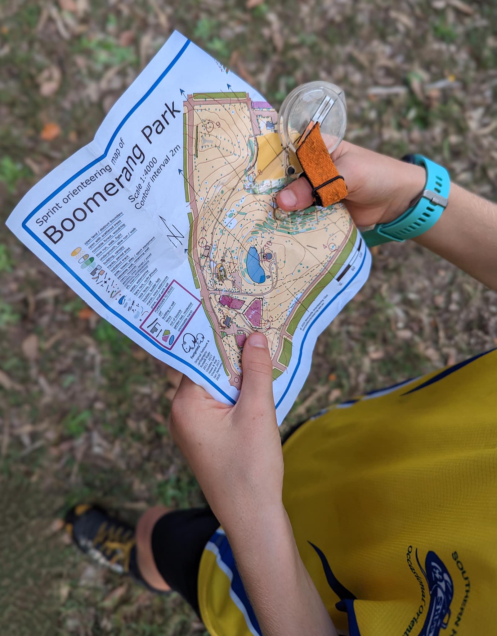
Orienteering maps are very detailed and specifically made by and owned exclusively by the individual clubs. They are provided at events as part of your entry and cannot be obtained anywhere else (other than the online maps for our free Permanent Courses).
What isn't permitted?
Dogs, smoking and fires are prohibited from ALL parking, assembly and competition areas.
Are events cancelled due to bad weather?
Scheduled events would only be only cancelled in the rare event of a bushfire threat or other extreme weather conditions, or access issues.
Is the sport dangerous? Am I insured?
There are various events most weeks of the year within NSW and Australia offering courses for all ages and abilities and there are annual national and international events open to all competitors. For more info on other bush events click here. All scheduled orienteering events can be found on Eventor.
What are the Rules for Orienteering?
Orienteering NSW "Competitors Rules - Foot Orienteering" can be found here. Of particular note for all competitors are:
- You must report to the finish following completion or abandonment of your course. If you do not report to the finish the organisers will come looking for you!
- Fair play: Except in the case of an accident or being seriously lost, obtaining assistance from other competitors or seeking to obtain assistance from other competitors, or providing assistance to other competitors during a competition is forbidden (shadowing/coaching of juniors/beginners excepted). Competitors who are seriously lost (ie. they do not know how to find the finish) can ask for assistance from another competitor.
- Restricted area & routes - competitors should be familiar with the map symbols for out of bounds/do not enter and uncrossable features, including those specific to Sprint Orienteering maps.
- Road safety rules must be followed, in particular for events where routes may include roads and areas with traffic.
- It is the duty of all competitors to help injured competitors. Injured competitors who need assistance should, if possible, blow a whistle (it is recommended all orienteers carry one) or ‘cooee’ three times periodically.
- Pets must not be taken to events held on private land, in nature reserves/national parks or similar areas where they are prohibited, or as otherwise advised by the organisers. This includes bringing a pet and keeping it secured inside a vehicle or trailer
Format and Rules
(For a general overview of what orienteering is about click here).
Competitors must obey ONSW Competitors Rules – Foot Orienteering and, for courses where there may be routes with roads or areas with traffic, note the important Road Safety Rules.
• The courses will be line courses (point to point). Competitors must visit all controls (checkpoints) in the order specified by the course setter (competitors still have choice on how to approach and navigate between controls). SPORTident electronic timing will be used for all Urban events (SI stick hire will be available at all events).
• There will be two different length courses offered at each event. The Short course will be approximately 2 - 2.5 km in length while the Long course will be approximately 4 - 5 km in length (where possible). A non-competitive introductory Mini course around 1km will also be offerred.
• Start times for the events will be between 4:45pm and 6:15pm. Course closure will be 7pm. Please choose a start time to ensure you will finish by this time. (The organisers need to pick up controls after this).
• The UFO Series will consist of four (4) events. The first three (3) events will be qualifying events. A competitor’s best two (2) completed events (not including a mispunch or DNF) in the same course will be tallied to produce a qualifying score. On the basis of this score competitors will be placed into grades for the final (see Calculating the Grades*).
• Scores for each qualifying event will be calculated as a ranking. 100 points for the first place, 99 for second, 98 for third and so on. The ranking method will apply to both the Long and Short courses. If a competitor mispunches, does not finish (DNF) or is disqualified (DSQ) they will be allocated 1 point. (The mini course is not competitive and will not be ranked).
• In the Final event competitors will run in their allocated grade*. Results from this event will determine the overall placing in each grade. Competitors that do not qualifiy for the Finals will still be able to enter either course but will not be eligible for a prize.
• To encourage event organisers, course setters and vetters will be allocated an average score of their successfully completed events for the event where they were an official. Thus they will not be disadvantaged by the scoring system.
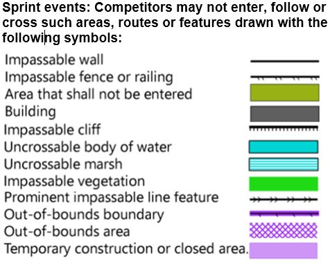 • Disqualification will be recorded in a competitor's result (at the discretion of the series co-ordinator) if they are observed or reported to have crossed an impassable/uncrossable feature (as shown in the sprint orienteering map symbols) or entered private property or other areas marked on the map as out of bounds.
• All competitors must report to the finish (so that search parties are not sent out!)
• Any queries should first go to the organiser for the day and then if necessary to the series organiser.
*Calculating the Grades
The grades for the Urban Foot Orienteering Series Final will be determined as follows:
• The grades for each course (i.e the Long course and the Short course) will be determined separately.
• After the conclusion of the qualifying rounds the competitors will be ranked according to their best two results. From these rankings the competitors will be put into grades.
Note: Competitors must have successfully completed at least two rounds on the same course to qualify.
• For each course the number of grades used will depend on the number of qualifiers as follows:
| Number of Qualifiers | Number of Grades |
| 0-19 | 1 |
| 20-35 | 2 |
| 36-51 | 3 |
| 52-64 |
4 |
| 65-80 | 5 |
| 81-96 | 6 |
• The numbers within each grade will be as even as possible with the excess going into the lower grades first.
For example if the long course has 43 qualifiers, then there will be 3 grades, A, B and C, with 14 in A grade, 14 in B grade and 15 in C grade. If the long course has 44 qualifiers then the numbers would be 14 in A grade, 15 in B grade and 15 in C grade. And so on.
 Become a member or renew your membership