Directions:
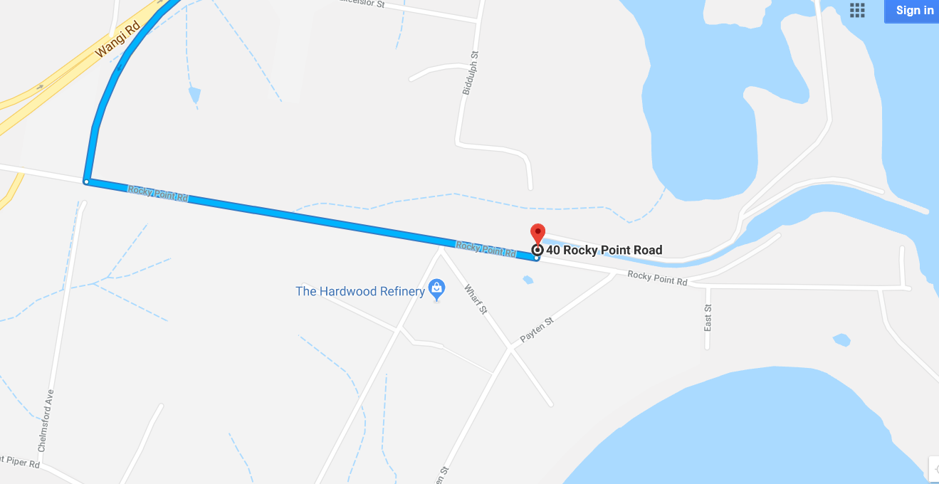
From Newcastle / Speers Point take the B53 south through Toronto. Take the exit to Eraring power station 10 km south of Toronto and turn left to go 800 m km east on Rocky Point road. Park on the left side of Rocky Point road.
From Sydney take the Morisset exit from the M1. Proceed through Morisset traveling north on the B53. 2.8 km after Dora Creek take the exit for Eraring power station, turn right (east) on Rocky Point road for 1.3 km. Park on the left side of Rocky Point road.
Map: Whiteheads Lagoon
Terrain:
Planner: Jim Lee
Vetter: Peter & Diana Charlton
Courses:
Very Easy, Easy, Short Moderate, Moderate, Short Hard, Medium Hard. A Longer extension to the Medium Hard may be offered.
| Course | Length(km) | Climb (m) | Controls | |
| Very easy | 1.9 | 20 | 12 | |
| Easy | 2.5 | 25 | 11 | |
| Moderate short | 2.6 | 35 | 8 | |
| Moderate long | 3.3 | 35 | 11 | |
| Hard short | 2.8 | 40 | 8 | |
| Harm medium | 5.1 | 105 | 14 | |
| Hard long | 6.3 | 110 | 16 |
Facilities: Toilets 500 m from assembly (in competition area)
Safety:
- Safety bearing: South to Rocky Point road.
- Rocky Point road is not permitted to be used except in emergency.
- There is dangerous fast flowing water in Eraring outlet channel (mostly fenced off).
- Courses are in places near the edge of the Lagoon and Lake Macquarie. Tracks near the lagoon are inundated at times.
- The Very Easy (and most other courses as well) crosses an inlet from the Lagoon on a fallen tree. There is a rope hand rail, and this crossing is on a main walking track.
- There are a number of small piles of rubbish including broken glass in the competition area. Other debris (e.g. wire mesh) may also be encountered.
Start times: 9:30 to 11:30am with course closure at 1pm. Please ensure you start your course with enough time to complete it prior to course closure
Notes:
- Rocky Point road is not permitted as a route choice (for your safety).
- On one part of the map the Scouts have made new plantings which are marked with red/white tape and/or logs. Please avoid damaging the plants when running in this area.
- Fire and regeneration activities have made some of the area easier running.
- Tracks near the lake edge may be inundated in places. The adjacent forest is usually open and runnable. I don’t expect there will be any problem with inundation, but I could be wrong.
- Tree root mounds have been used for control sites and these should be reliably mapped, but some older ones are no longer obvious and not all of the numerous new ones are mapped.
-
Full body cover is recommended for Moderate and Hard courses as there are patches of remnant lantana.
-
Hard Medium and Hard Long Courses: The Hard Medium course is the same as the Hard Long course with two controls (12 and 13) omitted. The same map and controls descriptions will be used for both, and you can decide which course you will complete before or after starting. There are comments in the control descriptions to remind you which controls to skip. At the point of divergence the map shows the route for the Hard Medium course with a dashed line (this is not a marked route) and a standard continuous line for the Hard Long. These courses have a map change after nine controls. Turn the map over to continue your course. This is indicated by a comment in the control descriptions.